For a printable version, please download from the link below. For contact information, please see the “Contact Me” tab on this site.
| k_wlodek_portfolio_2010_academic.pdf |
Project: New Identity for an Historic Site
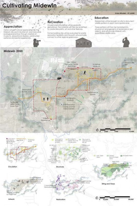
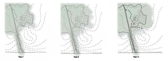
This studio project was a semester-long investigation of the Midewin National Tallgrass Prairie site in Joliet, IL, utilizing GIS mapping technology to locate, analyze and propose future identity for the 18,000 acre site.
This proposal starts with artists coming to the former military arsenal site to document it, and moves to create a post-industrial art museum on-site. Researchers will document wildlife patterns in quadrants, and sculptural elements will be placed to represent these patterns in a physical display. Dilapidated, unsafe structures on-site would be demolished, and the materials re-used for path and sculptural elements on-site.
This proposal starts with artists coming to the former military arsenal site to document it, and moves to create a post-industrial art museum on-site. Researchers will document wildlife patterns in quadrants, and sculptural elements will be placed to represent these patterns in a physical display. Dilapidated, unsafe structures on-site would be demolished, and the materials re-used for path and sculptural elements on-site.
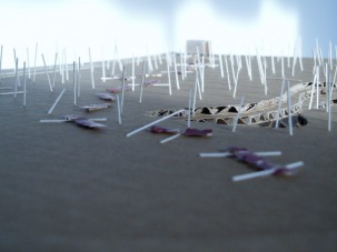
Project: Forest Floor Education in Cambridge, Ontario
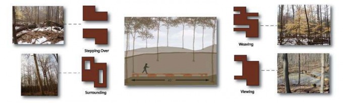
This studio project involved the RARE Research Reserve site in Cambridge, Ontario. The goal was to create a way of navigating the public through an existing old growth forest, educating and instilling appreciation, while incurring minimal damage to the existing, ecologically sensitive features.
This scheme proposes a system of disconnected boardwalks, which are placed based on local site conditions, and allow the visitor to experience ways one might move, navigating their way through the old growth forest. Boardwalk modules will be incrementally re-arranged or completely moved as the site evolves. The movements will reveal an additional element of occupation and evolution in the site history, one of human intervention. The forest will regenerate underneath the previous locations, and will provide visitors an additional visual experience of trying to place where and in what formation the boardwalk modules previously existed.
This scheme proposes a system of disconnected boardwalks, which are placed based on local site conditions, and allow the visitor to experience ways one might move, navigating their way through the old growth forest. Boardwalk modules will be incrementally re-arranged or completely moved as the site evolves. The movements will reveal an additional element of occupation and evolution in the site history, one of human intervention. The forest will regenerate underneath the previous locations, and will provide visitors an additional visual experience of trying to place where and in what formation the boardwalk modules previously existed.
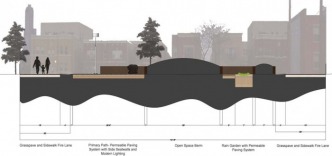
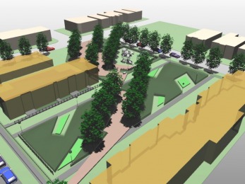
Project: Community Park for University Village
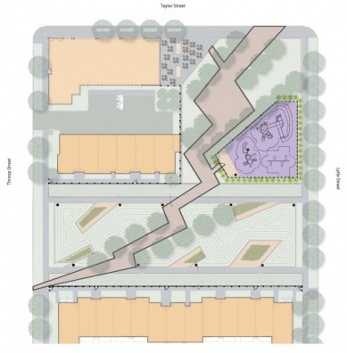
This project involved designing a park for the new Roosevelt Square development, keeping in mind several existing elements, and was to include an on site stormwater management component. This design approach attempts to capture the history of the Taylor Street site as the former location of the Riis Elementary School. The jagged paths, which are lined with seatwalls, pay homage to the destruction of Riis, and have a northeasterly orientation, meant to capture views of the Chicago skyline.
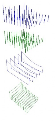
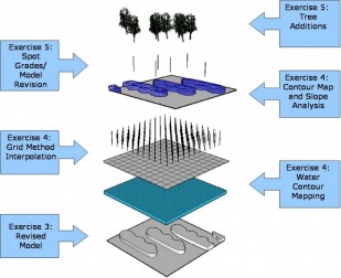
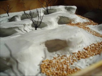
Project: Grading a Site Model
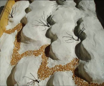
This Site Engineering project involved producing a clay earthwork model that went through various stages of refinement, including finding contours with water, interpolating actual slopes and contours in a grid, adding trees at spot grades, and re-grading the model to incorporate a path based on identified conditions.
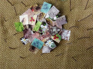
Project: A Cemetery for Body Donors
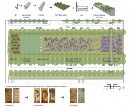
This assignment was to design a cemetery for people who have donated their bodies to science on a University of Chicago site. It was to include a meaningful progression of how the individual urn is eventually moved to its final location. This design approach involves a sculpture-like casket that is removed from a holding area above a cistern during an annual burial ceremony, and placed in a recessed basin. Collected rainwater is then released from the void, and family members disburse perennial seeds into it, which are carried throughout the site, creating ephemeral plant communities which speak of each individual year as they change as a result of casket placement and climatic conditions.
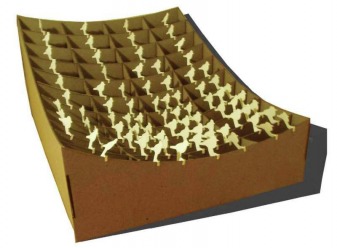
Project: Digitally Modeling a Nature-Based System
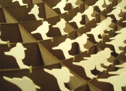
This digital media project involved planning and creation of a Rhino model, which was subsequently laser cut. Distances were calculated from a chosen point, and criteria for a system were correlated to this. This model represents Chicago bird watching sites with one, two or three birds representing density of birds based on distance from the lakefront.